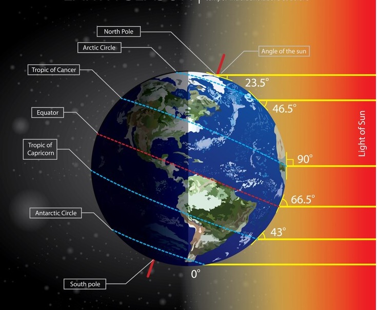
Latitudes and longitudes are essential geographical coordinates used to pinpoint specific locations on Earth’s surface. Latitudes, also known as parallels, are imaginary lines that run parallel to the equator, measuring the distance north or south from this central line. The equator itself marks 0 degrees latitude, while the poles are located at 90 degrees north and south latitudes, respectively. Longitudes, on the other hand, are imaginary lines known as meridians that run from the North Pole to the South Pole, passing through the poles and connecting at the equator. The prime meridian, located in Greenwich, England, serves as the reference point for measuring longitudes, with lines extending eastward to 180 degrees and westward to -180 degrees. Together, latitudes and longitudes provide a precise grid system that enables cartographers, navigators, and GPS systems to accurately locate any point on Earth’s surface.
The worksheet covers the following topics-
Globe
Axis
Equator
Parallels of latitude, Tropic of Capricorn, Tropic of Cancer
Important parallels of latitude, Arctic Circle, Antarctic Circle
Heat Zones of the Earth
Torrid Zone, Temperate Zone, Frigid Zone
What are longitudes?
The Prime Meridian
Longitude and the Time
Why do we have standard time?
Do revisit Parallels and Meridians and Weather and Climate Grade 5 worksheet.


