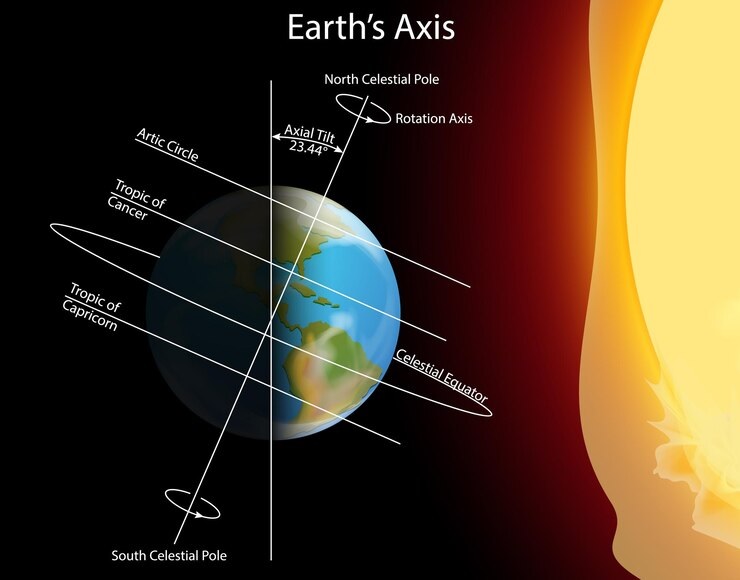
In our journey to understand maps and explore the world around us, we encounter two important concepts: parallels and meridians. These imaginary lines help us navigate and locate places on Earth’s surface.
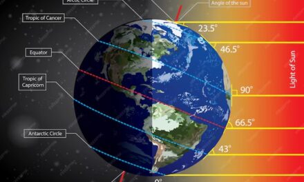
Parallels are lines that run parallel to the Equator, which is the imaginary line that divides the Earth into Northern and Southern Hemispheres. Parallels are also called lines of latitude. They help us measure distances north or south of the Equator. The Equator itself is at 0 degrees latitude, and as we move north or south, the latitude increases or decreases respectively.
Meridians, on the other hand, are lines that run from the North Pole to the South Pole and help us measure distances east or west of a reference point called the Prime Meridian. The Prime Meridian, located in Greenwich, England, is at 0 degrees longitude. Longitude lines are also known as meridians. As we move east or west from the Prime Meridian, the longitude increases or decreases respectively.
Understanding parallels and meridians helps us read maps, locate countries and cities, and navigate across the globe. Let’s explore these concepts further to unlock the secrets of our planet’s geography!
The worksheet covers the following topics: –
What are parallels?
Important features of parallels
How are parallels numbered?
Important parallels
what are Meridians
Important features of meridians
How are meridians numbered?
Locating places on the globe


